Case Study as part of a Web-based
Technical and Regulatory Guidance
Potosi Site
Washington County Lead District
Washington County, Missouri
1. Site Information
1.1
Contacts
Missouri Department of Natural Resources
Contacts:
Julieann Warren
Telephone: 573-751-1087
E-mail: [email protected]
Kathy Rangen
Telephone: 573-751-8393
E-mail: [email protected]
1.2 Name, Location, and Description
The Washington County Lead District Site (Figure 1-1) is part of Missouri’s
Old Lead Belt, which is located in the Ozark Mountains in southeast Missouri.
The Old Lead Belt provided approximately 80% of the lead produced in the
United States. In Washington County, the first mines were mostly surface
diggings advanced by manual labor with a pick and shovel. Starting in 1799,
deeper mines were started in the area. Lead mining continued until around
the end of the American Civil War. In the early 1900s, numerous small barite
mines operated in Washington County. Barite mining boomed in 1926, when it
was discovered that the mineral could be used as oil drilling mud. Washington
County was the world’s leading producer of barite before declining in the
1980s.
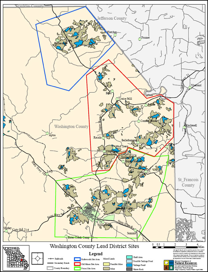
Figure 1-1. Washington County Lead District Site map.
The Washington County Lead District–Potosi Area site consists of approximately a 40–square mile region around the city of Potosi, in which extensive lead and barite mining, milling, and smelting activities were conducted for over 200 years. Potosi is located approximately 60 miles southwest of St. Louis. The Potosi Area site is located in the northeastern part of Washington County (Figures 1-2 through 1-5). The U.S. Environmental Protection Agency (EPA) proposed the Washington County Lead District–Potosi Area site for the National Priorities List (NPL) on September 19, 2007 and finalized it on March 19, 2008. The NPL is EPA’s national list of the most seriously contaminated sites that are eligible for federal cleanup under the CERCLA.
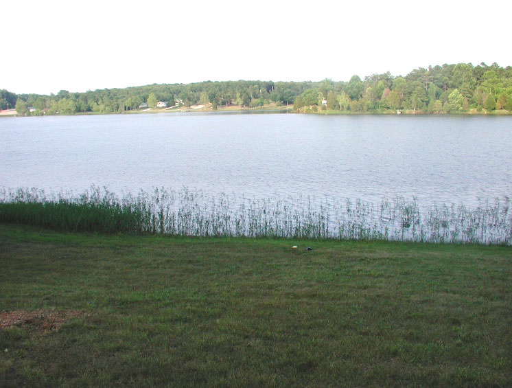
Figure 1-2. Former tailings pond now surrounded with residential housing.
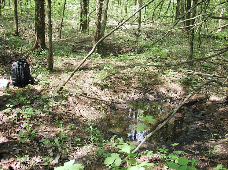
Figure 1-3. Hand-dug mine pits adjacent to residential area.
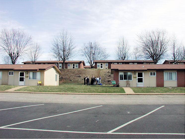
Figure 1-4. City of Potosi Section 8 Public Housing Authority built on lead mine waste.
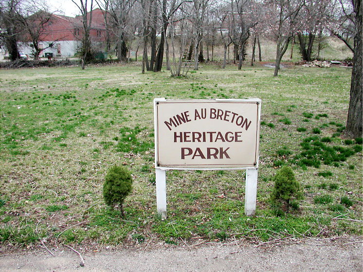
Figure 1-5. City park in downtown Potosi on former smelter site with elevated lead levels.
The primary contaminant of concern in the Potosi Area site is lead in soil and drinking water from mining, milling wastes, former smelter areas. To a lesser extent, there is concern for arsenic and barium in soil as well as cadmium in drinking water. This public health assessment will determine whether exposures to site-related contaminants have occurred in the past, present, or future at a level of health concern and recommend actions to reduce or prevent possible adverse health effects. Other sites in Washington County are also being investigated for mining-related contamination. The Washington County Lead District–Richwoods site and Old Mines site were investigated, proposed, and listed on the NPL at the same time as the Potosi Area site. Other areas in Washington County outside of the NPL sites are also being investigated for possible lead contamination.
2. Remedial Action
and Technologies
During a Removal Site Evaluation (RSE) study conducted September 2005–February
2006, a total of 1,280 residential properties were tested for soil lead levels.
Of this total, 675 properties (53%) contained lead in surface soils at concentrations
below the EPA’s preliminary remediation goal (PRG) of 400 parts per million
(ppm), 24 properties (2%) contained lead above 400 ppm only in the drip zone
(area where the roof drains rainwater to the ground), 446 residences (35%)
contained lead between 400 ppm and 1,200 ppm outside the drip zone, and 135
residences (10%) contained lead above 1,200 ppm outside the drip zone. Of
the 135 residences with lead above 1,200 ppm, approximately 110 properties
were excavated, back-filled, and reseeded as part of a time-critical removal
action.
The excavated lead-contaminated soils are being transported to the Indian Creek facility, where they will be treated, stored, and disposed of as a cover for the existing mine tailings at the facility. The soil will then be revegetated to serve as a remedy for the tailings.
The residences with soil lead levels 400–1,200 ppm will be excavated as part of a non-time-critical removal action. Approximately 900 yards will need to be excavated, back-filled, and reseeded as part of the remediation.
Approximately 270 residences had groundwater wells which were contaminated with lead or cadmium above the maximum contaminant level (MCL). These residences are currently being provided with bottled water or a reverse-osmosis filtration system.3. Performance
Performance criteria included the elimination of direct contact by removing
impacted residential soils, a reduction in child elevated blood levels (EBLs)
of lead, and a reduction in the bioavailability of the lead in the tailings
areas. Another goal of remediation was to provide an effective means of disposal
and treatment of contaminated soils while also providing an adequate cover
for a large tailings pile (Indian Creek). This dual usage of excavated soils
eliminated the need to transport the excavated lead-contaminated soils to
a landfill or other disposal facility and the associated costs.
4. Costs
Capital costs: Approximately $15,000 per property with 110 residential yards
remediated so far.
Operation and maintenance: To be determined.
- 2006–2007 cost per yard was $50,000; however, most yards were outside city limits and one full acre in size, and contamination was excavated to nearly 2 feet in depth. The cost per cubic yard was $45.
- 2008 cost per yard $26,000. Most removals were conducted within city limits, so the yards were much smaller, but the cost per cubic yard increased considerably.
- 2009 cost per yard $31,000.
5. Regulatory Challenges
None reported.
6. Stakeholder Challenges
There was significant public outreach from the start of the initial investigation.
The community was concerned about health issues and property values.
7. Other
Challenges and Lessons Learned
Involving the local officials from the beginning of the investigation, especially
the county health department, led to greater public support of the overall
process.
8. References
Missouri Department of Health and Senior Services. 2009. Public Health
Assessment Washington County Lead District-Potosi Area, Washington County,
Missouri (initial release).
U.S. Environmental Protection Agency Region 7. 2006. Final Statement of Basis for Remedial Action Plan, Indian Creek Facility, Washington County, Missouri. Air, RCRA and Toxics Division.